
easyMap Tools EMT Map Preparation Software for Anritsu Handheld Spectrum Analyzers
PC software that prepares geo-referenced maps and floor plans for coverage mapping and interference hunting on Anritsu handheld spectrum analyzers.
- Map source
- MapQuest (road maps from OpenStreetMaps)
- Zoom levels on instrument
- Up to seven zoom levels
- Supported instrument options
- Option 25, Interference Analysis; Option 431, Coverage Mapping
Overview
easyMap Tools (EMT) is PC software that provides maps in formats Anritsu handheld spectrum analyzers and interference analyzers can use for coverage mapping or interference hunting. It supports option 25, Interference Analysis, and option 431, Coverage Mapping, and helps users find and prepare geo-referenced maps and building floor plans for use on the instrument.
Map source
easyMap sources map data from MapQuest. MapQuest road maps originate from the OpenStreetMap project and can be downloaded wherever internet access is available.
Translation
The software translates the map source into a format readable by Anritsu handheld spectrum analyzers. The translation supports up to seven zoom levels on the instrument and allows panning and zooming, so a user can cover a large geographic area while retaining the detail needed to locate a signal. easyMap can also create legacy-mode geo-referenced maps, convert maps and floor plans for use on the instrument, and insert GPS information into maps that were not previously geo-referenced.
Field use
When used with an Anritsu handheld spectrum analyzer and the MA2700A interference hunter handle with GPS, compass and preamplifier, easyMap supports coverage mapping and interference hunting without manual handling of maps and compass headings or correction for magnetic deviation.
Key Features
- Create geo-referenced maps with pan and zoom capability
- Use MapQuest (an Open Source map provider) to source maps
- Create legacy mode geo-referenced maps
- Convert maps and floor plans to a form suitable for use on Anritsu handheld spectrum analyzers
- Insert GPS information into previously non-geo-referenced maps
- Supports option 25, Interference Analysis, and option 431, Coverage Mapping
- Up to seven zoom levels with panning and zooming on the instrument
- Works with the MA2700A interference hunter handle with GPS, compass and preamp
Specifications
| Map source |
MapQuest (road maps from OpenStreetMaps)
Freely downloadable wherever internet access is available
|
|---|---|
| Zoom levels on instrument |
Up to seven zoom levels
With panning and zooming on the instrument
|
| Supported instrument options | Option 25, Interference Analysis; Option 431, Coverage Mapping |
| Interference Mapping |
S332E, S362E, S412E, MT8212E, MT8213E, MS2712E, MS2713E, MS2722C, MS2723C, MS2724C, MS2725C, MS2726C, MS2720T, MS2034B, MS2035B
Requires option 25, Interference Analyzer
|
|---|---|
| Interference Mapping with pan and zoom mode (AZM maps) |
MT8221B, MT8222B, MT8220T
Requires option 25, Interference Analyzer
|
| Coverage Mapping |
S332E, S362E, S412E, MT8212E, MT8213E, MT8221B, MT8222B, MT8220T, MS2712E, MS2713E, MS2722C, MS2723C, MS2724C, MS2725C, MS2726C, MS2720T, MS2034B, MS2035B
Requires Option 431, Coverage Mapping
|
| Product families | Site Master, LMR Master, Cell Master, BTS Master, Spectrum Master, VNA Master |
| Operating system | Windows XP, Service Pack 2 or higher; Windows Vista (32 bit or 64 bit); Windows 7 (32 bit or 64 bit); Windows 8 (32 bit or 64 bit); Windows 10 (32 bit or 64 bit) |
|---|---|
| RAM |
1 GB
Minimum
|
| Available hard disk space |
1 GB
Minimum
|
Applications
- Coverage mapping
- Interference hunting
- Interference mapping
- Indoor mapping with building floor plans
Documents & Resources
Related Products
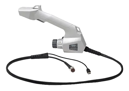
Handheld direction finding system with built-in GPS receiver, electronic compass and preamplifier for interference mapping with Anritsu analyzers.
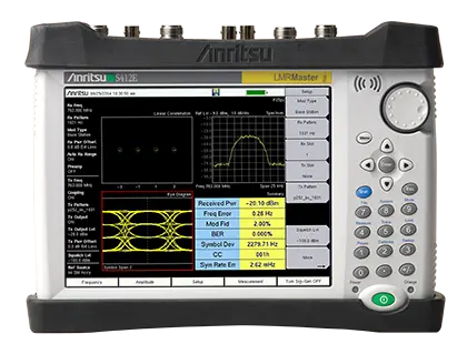
Handheld LMR test set combining a P25/DMR/TETRA/NXDN signal analyzer and generator, a 9 kHz–1.6 GHz spectrum analyzer and a 500 kHz–1.6 GHz VNA.
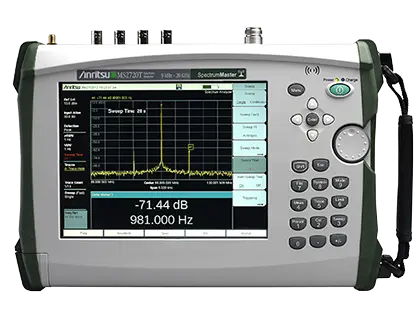
Handheld spectrum analyzer covering 9 kHz to 9, 13 or 20 GHz with touch screen, full-band preamplifiers and optional tracking generators.